 Call or text 864-372-9585
Home / Services
3D Laser Scanning
Greenville & Upstate South Carolina · Continental US projects
A building is easier to plan around when your team can revisit its geometry from the office. We use a Trimble X9 to capture accessible, visible surfaces from multiple scan positions, then register the data into a coordinated point cloud.
Scope your project ↗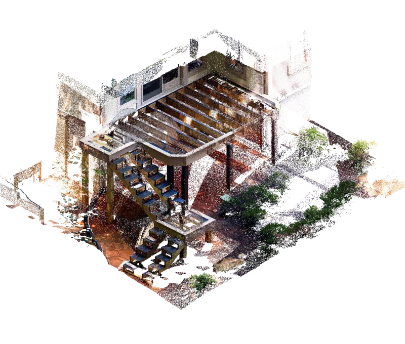
When this is useful
Information for
the next decision.
- Renovations with incomplete record drawings
- Stair, rail, and steel connections to existing buildings
- Congested rooms and equipment access
- Documentation before changes or closeout
A scoped deliverable
What your package
can include.
- Registered point cloud in the agreed format
- Defined coverage and coordinate basis
- Focused views of critical conditions
- Cleanup and modeling when included in scope
Before we commit
Agree on the details that matter.
Before scanning, we agree on access, coverage, critical dimensions, intended use, and the accuracy expectations for the project. Laser scans record visible surfaces; hidden construction and blocked areas need a separate investigation or an agreed access plan.
How we approach accuracy and coverage ↗Your project, your scope
What does your team need to know?
Send the project location, approximate area, intended use, and any reference files. We will help define the capture and deliverables.